Judi Barzani
Writer
How Erbil's Oldest Geometry Became a Blueprint for Growth
An architect's reflection on how Erbil's six-thousand-year-old Citadel and expanding network of concentric ring roads continue to shape the capital's rapid modern development.
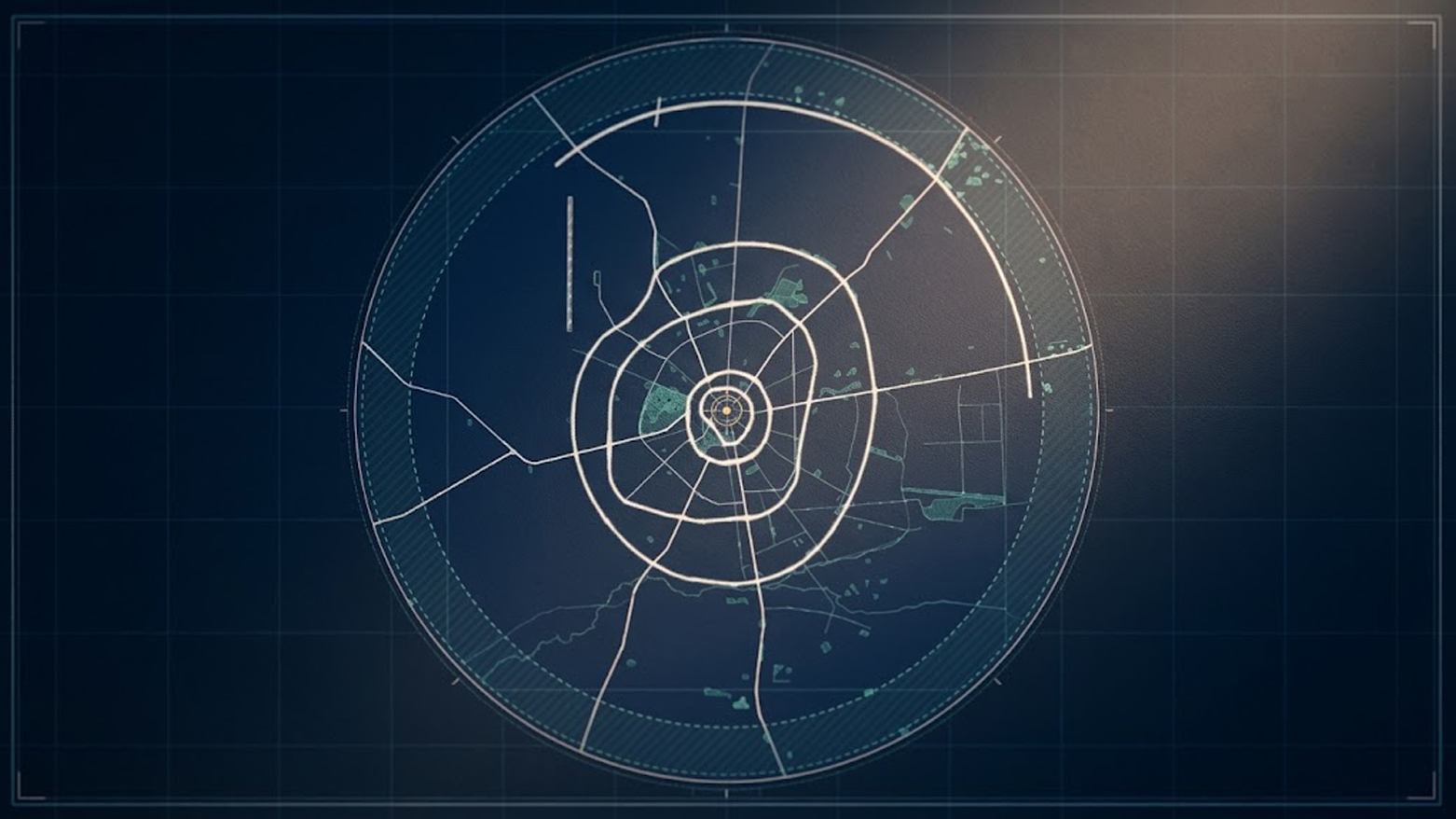
Every city has a logic, and most people who live in one never see it. In Erbil the logic is unusually clear, and you read it best from the air. The capital opens outward from a single point in a series of concentric rings, so exact that pilots and residents alike have taken to calling it the Spider City. At the center of the web sits the Citadel, a mound of packed earth and stacked houses that has been lived on for close to six thousand years without a single break. Everything else in Erbil is an answer to that mound.
As an architect, I find this rare and worth pausing on. Cities usually grow by accident, spreading along a river or a trade road until the map looks like a spill. Erbil grew around a fixed idea. The Citadel is the datum, the zero point from which the whole city is measured, and the modern capital has never once abandoned it.
Looking at inside a log of a tree, you can count its years. Open a plan of Erbil and you can do the same. Move outward from the Citadel and you cross the 30 Meter Road, then the 40, the 60, the 100, the 120, and now the 150 Meter Road, each one wider and further out than the last, each one marking a decade of ambition. The naming is plain to the point of poetry. A road is called by its width, and its width tells you the scale of the city that built it.
This is where urban design stops being decoration and becomes governance. A ring road is not only asphalt. It is the armature on which neighborhoods hang. Lay the ring first and the districts, the towers, the markets, and the parks find their place along it in good order. Lay the fabric first and you spend the next fifty years cutting roads through it at ruinous cost. Erbil, for the most part, laid the rings first.
The achievement of the Kurdistan Regional Government here is easy to underrate, because it is infrastructure, and infrastructure is invisible when it works. The 120 Meter Road, opened in 2017, gave the growing capital its outer edge for a time. The 150 Meter Road, a loop of roughly seventy kilometers now nearing completion, pushes that edge much further out and folds a dozen outlying towns into the body of the city. Much of this was carried out by Kurdish firms rather than foreign giants, and that matters, because a region that can build its own skeleton can build almost anything on top of it.
These rings are the reason the real estate boom of the past decade had somewhere to land. Empire World, Dream City, the tall residential complexes rising along the wider roads, none of them would make sense without the circulation that feeds them. The logic is still running. The Green Belt now taking shape around the outer city is, in plan, simply the next ring, except this one is drawn in trees and water rather than concrete. It reads as an ecological edge sketched by the same hand that drew the roads, meant to cool the city, clean its air, and give its growth a limit.
Erbil is not finished, and it has made the ordinary mistakes of a city in a hurry. Traffic still bites, and some inner districts have been left behind by the rush outward. But the underlying idea has held for six thousand years and through many rulers, and the government of the day has honored it rather than fought it. That is the quiet discipline behind Erbil's skyline. The towers get the photographs, but the rings are the real design, and they are the reason the capital has grown so fast without ever losing its shape.