A 4,300-Year-Old Clay Map Found Near Kirkuk
The palm-sized tablet from the ancient city of Gasur, held at Harvard, marks the cardinal directions and shows a district between two hill ranges
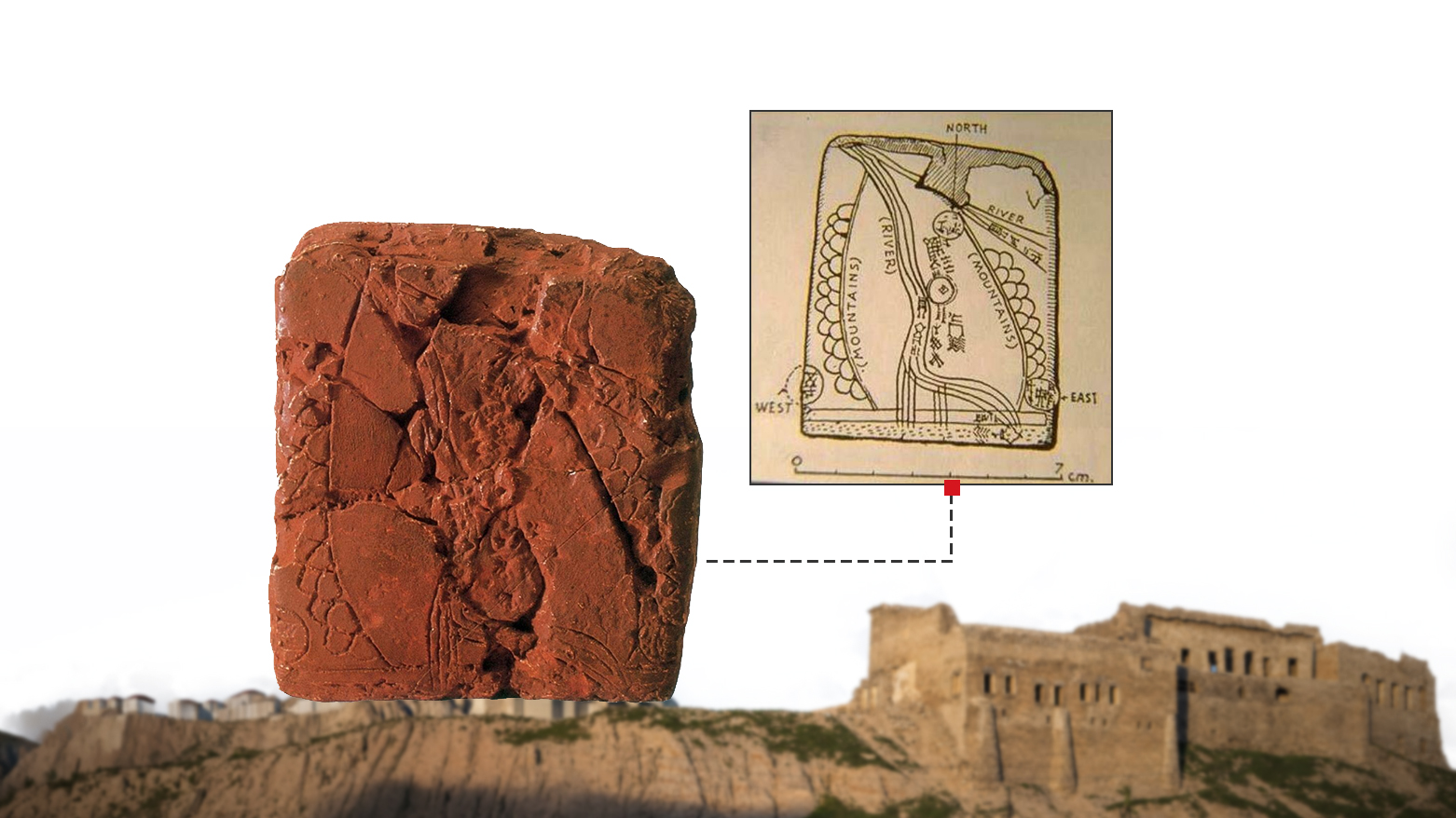
ERBIL (Kurdistan 24) - A small clay tablet found in 1930 at the ancient site of Gasur in Kirkuk province is regarded by many scholars as the earliest known topographic map, dating to about 2300 BC, which makes it roughly 4,300 years old.
A Harvard University expedition found it at Yorghan Tepe, south of the city of Kirkuk, and it is now held at Harvard’s Semitic Museum.
The tablet measures about 7.6 by 6.8 centimeters and dates to the Akkadian period, when the site was known as Gasur.
A thousand years later the city was called Nuzi.
It shows a district bounded by two ranges of hills, drawn as scale-like patterns, with a watercourse running through the valley between them, and small circles that scholars read as settlements or fields. Its cardinal directions are clearly marked, which a leading history of cartography calls a first among known maps. The inscription names the area, and part of the text has been read as a label for the map’s regions.
Harvard’s team, which included archaeologists Edward Chiera, Robert Pfeiffer and Richard Starr, excavated the site over several seasons, and the tablet was published in 1935 by the scholar Theophile Meek.
About 5,000 tablets from the site are known, held mainly at Harvard, the University of Chicago’s Oriental Institute and the Iraq Museum in Baghdad.
Researchers say the map reflects the sophistication of land management in the third millennium BC, though they disagree over exactly what it depicts and over its precise age, with dates ranging from about 2500 BC to about 2200 BC. Other objects, such as a wall painting at Catalhoyuk in Turkey, are also put forward as early maps.