Planet Labs Halts High-Resolution Middle East Imagery Amid Ongoing Conflict
U.S. government request prompts tighter controls on satellite data as regional war escalates
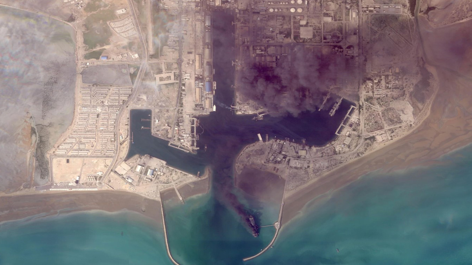
ERBIL (Kurdistan24) — U.S.-based satellite imagery firm Planet Labs announced Saturday it will stop publishing high-resolution images of key areas affected by the ongoing Middle East conflict, following a request from the administration of Donald Trump.
In a notice to clients, the company said the U.S. government had called for an “indefinite withholding of imagery,” prompting a shift to a more restrictive access model.
Effective retroactively from March 9, 2026, Planet stated it would extend publication delays for all new imagery within the designated area of interest and release images only on a case-by-case basis, primarily for urgent or mission-critical needs.
The restricted zone includes all of Iran, allied military installations, Gulf states, and other active conflict areas, according to the company. Planet added that the policy is expected to remain in place until the end of the conflict.
The decision comes amid escalating hostilities, as the United States and Israel have carried out joint strikes against Iran since late February. In response, Tehran has launched daily missile barrages targeting Israel and several neighboring countries, intensifying regional instability.
Founded in 2010 by former NASA scientists, Planet’s satellite imagery is widely used by media organizations, researchers, and analysts due to its rapid availability—often within hours of capture.
However, such data can also carry military implications, including the potential to assist in identifying strategic targets such as bases or radar systems.
Earlier in March, the company had already imposed a temporary delay on Middle East imagery, initially set at 96 hours and later extended to two weeks, before moving to the current indefinite restrictions.
Another major provider, Vantor, has implemented similar limitations.
Under U.S. law, companies operating high-resolution satellite imaging services can be subject to restrictions on national security or foreign policy grounds.
In practice, firms like Planet comply with such directives under their licensing frameworks to avoid potential sanctions, underscoring the increasing intersection between commercial satellite data and geopolitical tensions.
The restriction of high-resolution satellite imagery reflects the growing importance of information control in modern conflict, particularly amid escalating tensions between the United States, Israel, and Iran.
Commercial providers like Planet Labs have made near-real-time geospatial intelligence widely accessible, enabling governments, media, and analysts to monitor military activity and verify developments on the ground.
However, this transparency also carries operational risks, as such imagery can reveal sensitive military positions and potentially aid targeting during active hostilities.
Acting within established legal authorities, the administration of Donald Trump has moved to limit access to this data, with other providers such as Vantor adopting similar measures.
The decision highlights the increasing overlap between civilian technology and military strategy, as well as the growing role of private satellite firms in national security.
While aimed at preserving operational security, the restrictions may also reduce transparency, limiting the ability of journalists and researchers to independently assess developments and humanitarian impacts on the ground.