Winter Storm Blankets Duhok, Erbil, and Sulaimani With Record Snowfall
Heavy snow hit Kurdistan, with 60cm on Mount Pirs and 50cm in Haji Omran. A second wave is forecast for Wednesday, bringing freezing temps and low visibility.
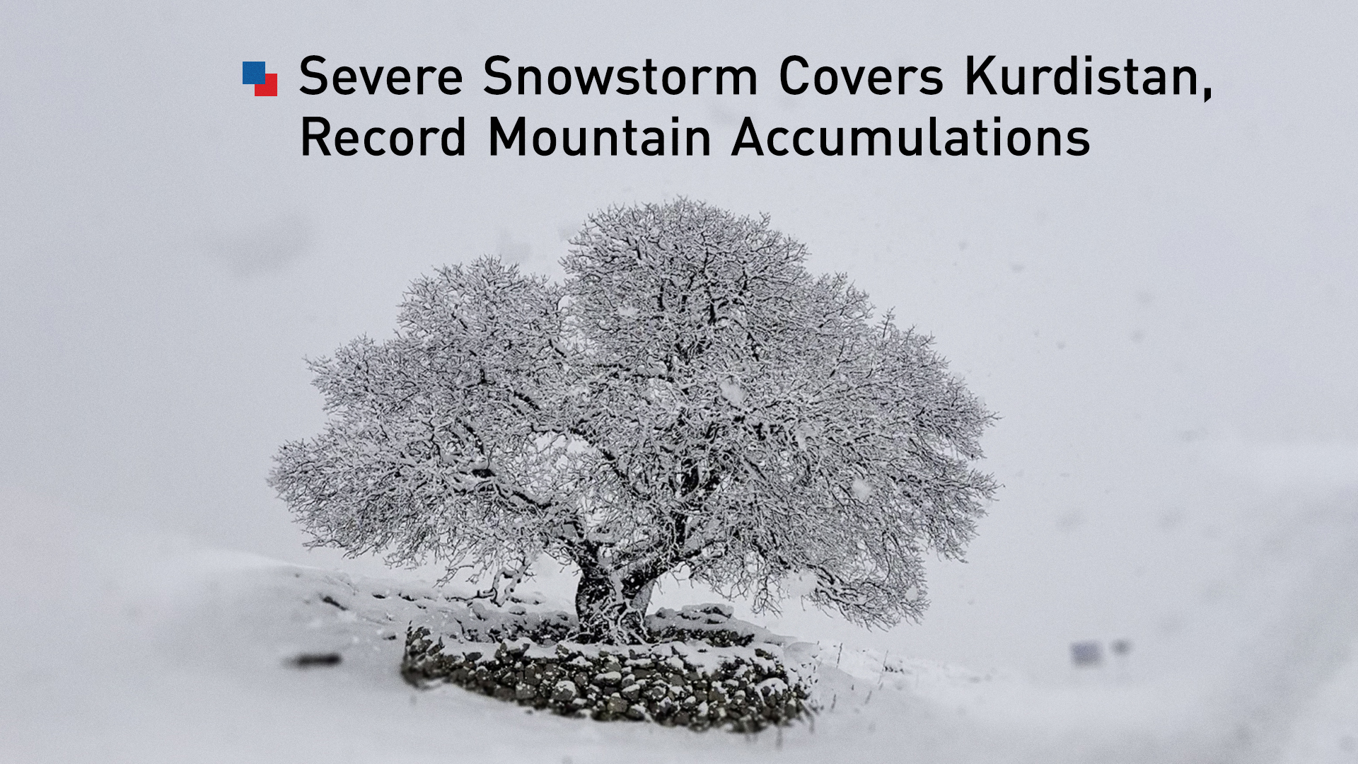
ERBIL (Kurdistan24) – A severe winter storm system has deposited substantial snow accumulation across the Kurdistan Region over the past 24 hours, with meteorological officials recording depths exceeding half a meter in high-altitude areas, while simultaneously issuing alerts for a second wave of precipitation expected to impact the area during the final days of 2025.
The General Directorate of Meteorology and Seismology of the Kurdistan Regional Government (KRG) released comprehensive data on Tuesday, detailing the intensity of the recent weather event.
According to the directorate’s announcement, a "severe and dense wave of snowfall" has swept through various districts, altering daily life and transport conditions across the governorates of Duhok, Erbil, and Sulaimani.
While the immediate system has left a significant footprint, particularly in mountainous zones, forecasters indicated that the region remains in an active weather corridor, with a fresh cold front and additional snow predicted to arrive by Wednesday afternoon.
Record Accumulations in Duhok Governorate
The data released by the General Directorate of Meteorology and Seismology highlighted the Duhok Governorate as the area receiving the heaviest concentration of snow during the 24-hour reporting period ending Tuesday.
The most significant accumulation was recorded on Mount Pirs, where snow depth reached 60 centimeters, the highest figure reported across the entire Kurdistan Region during this specific wave.
The impact of the storm in Duhok was widespread, covering most areas within the governorate’s borders. Following the peak accumulation on Mount Pirs, the town of Kani Masi recorded substantial snowfall, with depths reaching 35 centimeters.
Other significant accumulations were observed in Bamarni, which saw 26 centimeters of snow, and Sarsing, where 23 centimeters were recorded. The district of Amedi also experienced heavy precipitation, with officials measuring 20 centimeters of snow on the ground.
The meteorological data provided a granular breakdown of the storm’s reach into other towns within the Duhok Governorate. The localities of Dinarta, Zawita, and Chamanke each recorded identical accumulations of 18 centimeters.
Meanwhile, Deraluk saw 17 centimeters, and Mangish recorded 15 centimeters. Further down the scale of intensity, the towns of Bakirman, Shiladze, and Batufa each received 13 centimeters of snow.
Accumulations continued in the lower elevations and surrounding districts, though with slightly less intensity. Akre and Sharman both recorded 12 centimeters, while Atrush and Bjil each saw 10 centimeters.
The storm's reach extended to Krdasen, which received 5 centimeters, and Ba'adre, which recorded 4 centimeters. Even the administration of Zakho and the Duhok city center, areas that typically see less accumulation than the high peaks, were affected, recording 3 centimeters and 1.5 centimeters respectively.
Erbil and Sulaimani Impact
In the Erbil Governorate, the storm whitened vast stretches of the mountainous terrain, with the border crossing area of Haji Omran leading the accumulation tables. According to the KRG meteorological statistics, Haji Omran received 50 centimeters of snow, marking it as one of the most heavily impacted areas in the region alongside Mount Pirs.
The precipitous terrain around Erbil saw varying degrees of snowfall. Hiran recorded 27 centimeters, while the towns of Shaqlawa and Sidekan both reported 25 centimeters. Choman, a key district in the northeastern mountainous corridor, received 22 centimeters.
The tourist destination of Pirmam recorded 18 centimeters, followed by Rawanduz with 15 centimeters.
The Soran administration, a hub for the mountainous districts, recorded 11 centimeters of snow. Koya received 10 centimeters, Degala recorded 8 centimeters, and the town of Khalifan saw 6.5 centimeters.
To the east, the Sulaimani Governorate and the Raparin Administration also faced the brunt of the cold front. The data indicated that Penjwen and Qaladze were the hardest hit in this sector. The monitoring stations in Yakhsamar and Qaladze both recorded 23 centimeters of snow. Sarkapkan followed closely with 19 centimeters, while the town of Penjwen itself recorded 17 centimeters.
Other areas in Sulaimani saw moderate accumulation. Mawat received 12 centimeters, while Takiya Kakamand and Ranya both recorded 11 centimeters. Chwarqurna saw 9 centimeters, Sitak recorded 5 centimeters, and Qaradagh received 3 centimeters. The lowest recorded amount in this governorate was in Qirga, which saw 1 centimeter of snow.
Forecast: A Second Wave Approaches
As residents and municipal teams grappled with the cleanup from the initial storm, the General Directorate of Meteorology and Seismology issued a forward-looking advisory on Tuesday regarding a subsequent weather system.
According to the latest forecasts released on December 30, the Kurdistan Region is bracing for another wave of cold temperatures and snowfall that will define the final 48 hours of the year.
For the remainder of Tuesday, meteorologists predicted that the sky would remain generally clear but intensely cold. In the mountainous areas, conditions are expected to be partly cloudy with a high probability of frost and freezing temperatures developing overnight.
The directorate warned that temperatures in the centers of all governorates are projected to drop below zero degrees Celsius, creating hazardous conditions for any wet surfaces remaining from the previous day's precipitation. Wind speeds on Tuesday were forecast to be gentle, ranging from 5 to 15 kilometers per hour, blowing from a northeasterly direction, with visibility holding between 9 to 10 kilometers.
However, the weather pattern is expected to shift on Wednesday, December 31, 2025. Forecasts indicate that while the day will begin cold and partly cloudy, a new wave of snowfall will move into the region during the afternoon hours.
This secondary system is predicted to cover specific high-altitude and border regions, including the borders of the Duhok Governorate, the Zakho Administration, Mergasor, Amedi, the borders of the Soran Administration, and parts of the Raparin Administration.
The forecast also specifically noted that Mount Safin in the Erbil Governorate is expected to receive snow during this Wednesday wave. The predicted accumulation for this second event is estimated to be between 5 and 10 centimeters.
As the intensity of the wave increases throughout Wednesday, meteorologists warned of the possibility of light rain mixed with snow in various other areas outside the primary snow zones.
Operational Conditions and Warnings
The incoming system on Wednesday will bring shifts in wind and visibility patterns.
Wind speeds are expected to remain gentle, between 10 to 15 kilometers per hour, but will shift to a northwesterly direction. While temperatures may rise slightly in some areas not directly hit by the snow, the directorate noted that areas falling under the influence of the snow wave will see temperatures drop.
Visibility is a primary concern for the impending system on New Year's Eve. While general visibility is expected to be between 7 to 9 kilometers, officials warned that it will decrease to less than 1 kilometer during periods of active snowfall, posing significant risks for travel.
The General Directorate provided specific high-temperature forecasts for Wednesday, underscoring the pervasive cold. Erbil is expected to reach a high of only 7 degrees Celsius.
Sulaimani is forecast to reach 5 degrees Celsius, while Duhok will see a high of just 3 degrees Celsius. Zakho is predicted to reach 4 degrees Celsius, Halabja 5 degrees Celsius, and the Garmian administration is expected to be slightly warmer with a high of 9 degrees Celsius.
In light of the heavy accumulation from the past 24 hours and the freezing conditions expected to continue through Wednesday, authorities have issued safety warnings to the public.
The General Directorate of Meteorology and Seismology explicitly asked citizens and drivers to exercise extreme caution regarding ice and fog when traveling, particularly in mountainous areas where the combination of the 60-centimeter base from the first storm and the incoming fresh snow could create treacherous driving conditions.